Q-maps
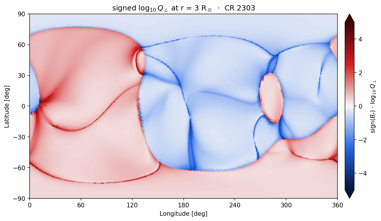
A synoptic Q-map: signed-log₁₀ Q⊥ on a longitude/latitude grid at a fixed radius,
sliced from a built volume with no re-ingest or tracing; the viewpoint-independent sibling of
render. The displayed quantity is sign(B·r̂) · log₁₀ Q⊥, signed by the radial-field
polarity: the neutral line between the two colours traces the base of the heliospheric
current sheet, and the saturated ridges are the S-web arcs. The grid is in the solution's own
declared frame (--frame, Carrington or Stonyhurst longitudes; see
Camera and viewpoint).
Build the volume with --outer-radius equal to the map radius, then slice:
qorona build data/coconut_corona.CFmesh.xz -o data/coconut_corona_or3.qor \
    --timestamp 2025-10-09T18:19:52 --outer-radius 3
qorona qmap data/coconut_corona_or3.qor -o data/qmap.png --radius 3
The flags that matter
--radius: shell radius in solar radii (default 3).--resolution NTHETAxNPHI: display grid (default 720x1440; interpolated, capped by the build's pitch).--slog-max: colour ceiling for the signed log (default 5).--export npz: also write the raw shell arrays beside the figure.